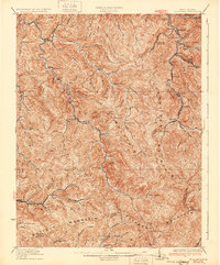
1931 Map of Bald Knob
USGS Topo · Published 1931About this map
Cherry Pond Mountain and Guyandot Mountain dominate this landscape, where the coal-country economy follows the deep valleys of the Little Coal River and its tributaries. The Chesapeake and Ohio RR snakes along the watercourses, serving established mining and timber communities such as Whitesville, Red Dragon, and Montcoal. This 1928 revision by G.E.Sisson documents a network of rural education, identifying many family-named schools like Bothwell Sch, Mooney Sch, and Canevwood Sch that served these hollows before the consolidation of the late 20th century. The intricate topography reveals how the rugged terrain dictated settlement patterns, with towns like Wharton and Barrett clustered tightly in the narrow floodplains of the Pond Fork.
Find a feature on this map
75 named features on this map. Tap any name to fly to it.
Don’t see what you’re looking for? This feature index may not catch every label — zoom into the map to look around manually.
Map Details
Editions of this 1931 Bald Knob Map
2 editions found
Other maps of this area

1891 · Oceana
USGS Topo · 1:125,000

1891 · Raleigh
USGS Topo · 1:125,000

1893 · Oceana
USGS Topo · 1:125,000

1897 · Kanawha Falls
USGS Topo · 1:125,000

1897 · Raleigh
USGS Topo · 1:125,000

1898 · Oceana
USGS Topo · 1:125,000

1899 · Charleston
USGS Topo · 1:125,000

1900 · Kanawha Falls
USGS Topo · 1:125,000

1901 · Kanawha Falls
USGS Topo · 1:125,000

1902 · Raleigh
USGS Topo · 1:125,000