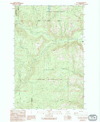
1989 Map of Bald Knob
USGS Topo · Published 1994About this map
The Colville Indian Reservation and two national forests converge at this mountainous section of the Pacific Northwest, captured in the late 1980s. The landscape is defined by the West Fork Sanpoil River and its numerous tributaries, including Gold Creek and Nineteenmile Creek. This period of the landscape reflects a legacy of resource extraction and land management, with several scattered Mine and Prospect labels indicating historic mineral exploration. A specific focus on local mining history is found in the south, where the Bungalow Mine sits near Bungalow Creek. Large tracts of the Colville National Forest and Okanogan National Forest dominate the northern terrain, separated by the Okanogan Co Ferry Co boundary line. Notable landmarks such as Bald Knob and Long Lake provide distinct navigational points for those studying the topography and hydrology of the region.
Find a feature on this map
26 named features on this map. Tap any name to fly to it.
Don’t see what you’re looking for? This feature index may not catch every label — zoom into the map to look around manually.
Map Details
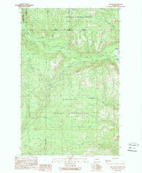
Editions of this 1989 Bald Knob Map
2 editions found
Other maps of this area

1904 · Republic
USGS Topo · 1:125,000

1948 · Republic
USGS Topo · 1:62,500

1951 · Wauconda
USGS Topo · 1:62,500

1951 · Republic
USGS Topo · 1:62,500

1953 · Seventeenmile Mtn.
USGS Topo · 1:62,500

1953 · Bald Knob
USGS Topo · 1:62,500

1954 · Okanogan
USGS Topo · 1:250,000

1958 · Okanogan
USGS Topo · 1:250,000

1958 · Aeneas
USGS Topo · 1:62,500

1984 · Republic
USGS Topo · 1:100,000