
1953 Map of Bald Knob
USGS Topo · Published 1955About this map
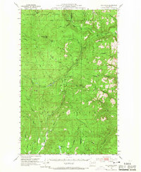
The Colville Indian Reservation dominates this mid-century landscape in the heart of Washington's northern highlands, where the Sanpoil River and Nespelem River carve through the forested terrain. This 1953 survey captures an era of resource extraction and mountain accessibility, evidenced by the Bungalow Mine and scattered prospects near Bald Knob. The presence of the Lookout Trail and Swan Lake Trail suggests a network used for fire management and backcountry transit through the Colville National Forest and Chelan National Forest. Notable water bodies like Owhi Lake and Little Owhi Lake provide clear landmarks within the reservation boundaries. This map is a significant record for understanding the intersection of tribal lands, federal forest management, and early mining activity before more modern road developments altered the high-country travel routes.
Find a feature on this map
40 named features on this map. Tap any name to fly to it.
Don’t see what you’re looking for? This feature index may not catch every label — zoom into the map to look around manually.
Map Details
Editions of this 1953 Bald Knob Map
3 editions found
Other maps of this area

1902 · Osoyoos
USGS Topo · 1:125,000

1904 · Osoyoos
USGS Topo · 1:125,000

1904 · Republic
USGS Topo · 1:125,000

1948 · Republic
USGS Topo · 1:62,500

1950 · Nespelem
USGS Topo · 1:62,500

1950 · Alameda Flat
USGS Topo · 1:62,500

1951 · Wauconda
USGS Topo · 1:62,500

1951 · Republic
USGS Topo · 1:62,500

1952 · Alameda Flat
USGS Topo · 1:62,500

1952 · Keller
USGS Topo · 1:62,500