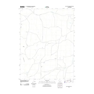
2010 Map of Bald Mountain
USGS Topo · Published 2010About this map
Bald Mountain rises over a landscape defined by an intricate network of seasonal drainages and local access roads in this 2010 survey of Moffat County. The area’s hydrological character is marked by the convergence of Sand Creek and the meandering Red Wash, while more specific water sources like Cutshaw Spring provide localized points of interest for those studying the region’s topography. The terrain is notably etched by numerous draws, including Shaffers Draw and Alkali Draw, which illustrate the erosion patterns characteristic of this high-desert environment.
Find a feature on this map
22 named features on this map. Tap any name to fly to it.
Don’t see what you’re looking for? This feature index may not catch every label — zoom into the map to look around manually.
Map Details
Editions of this 2010 Bald Mountain Map
This is the sole edition of this map. No revisions or reprints were ever made.
Other maps of this area

1916 · Craig
USGS Topo · 1:125,000

1954 · Vernal
USGS Topo · 1:250,000

1954 · Craig
USGS Topo · 1:250,000

1957 · Craig
USGS Topo · 1:250,000

1958 · Vernal
USGS Topo · 1:250,000

1958 · Craig
USGS Topo · 1:250,000

1958 · Maybell
USGS Topo · 1:62,500

1960 · Craig
USGS Topo · 1:250,000

1960 · Vernal
USGS Topo · 1:250,000

1962 · Craig
USGS Topo · 1:250,000