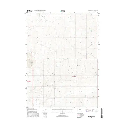
2016 Map of Bald Mountain
USGS Topo · Published 2016About this map
Bald Mountain rises as the central topographical landmark in this northwestern Colorado high-country landscape. This Moffat County terrain is defined by a series of drainages and seasonal watercourses, including Red Wash in the north and the complex network of Sand Cr and Bald Mountain Draw to the south. The mapping shows a sparsely populated area where cattle ranching or land management is supported by features like Cutshaw Spring and the drainage at Alkali Draw. Local infrastructure consists primarily of a rural road network, with routes such as Co RD 19 and Co RD 71 providing access through the draws and across the flats near Lucas Hill. The presence of Hardgrove Rim suggests the layered geological benches typical of this region, providing a detailed record of the land as it appeared in the early twenty-first century.
Find a feature on this map
22 named features on this map. Tap any name to fly to it.
Don’t see what you’re looking for? This feature index may not catch every label — zoom into the map to look around manually.
Map Details
Editions of this 2016 Bald Mountain Map
This is the sole edition of this map. No revisions or reprints were ever made.
Other maps of this area

1916 · Craig
USGS Topo · 1:125,000

1954 · Vernal
USGS Topo · 1:250,000

1954 · Craig
USGS Topo · 1:250,000

1957 · Craig
USGS Topo · 1:250,000

1958 · Vernal
USGS Topo · 1:250,000

1958 · Craig
USGS Topo · 1:250,000

1958 · Maybell
USGS Topo · 1:62,500

1960 · Craig
USGS Topo · 1:250,000

1960 · Vernal
USGS Topo · 1:250,000

1962 · Craig
USGS Topo · 1:250,000