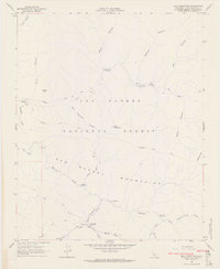
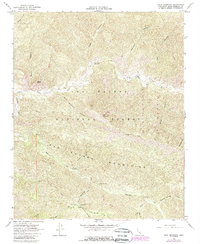
1964 Map of Bald Mountain
USGS Topo · Published 1965About this map
San Rafael Mountains dominate this 1964 topographic survey of the Los Padres National Forest, a terrain defined by deep canyons and high ridges. The Sisquoc River carves through the central portion of the map, fed by a network of seasonal drainages including Manzana Creek and Potrero Canyon. This area reflects a wilderness landscape largely accessible by a system of rugged paths like the Pack Trail and Hurricane Deck Trail.
Find a feature on this map
42 named features on this map. Tap any name to fly to it.
Don’t see what you’re looking for? This feature index may not catch every label — zoom into the map to look around manually.
Map Details
Editions of this 1964 Bald Mountain Map
5 editions found
Other maps of this area

1902 · Santa Ynez
USGS Topo · 1:125,000

1905 · Santa Ynez
USGS Topo · 1:125,000

1905 · Lompoc
USGS Topo · 1:125,000

1941 · San Rafael Mtn.
USGS Topo · 1:62,500

1941 · McPherson Peak
USGS Topo · 1:62,500

1942 · Lompoc
USGS Topo · 1:125,000

1942 · San Rafael Mtn.
USGS Topo · 1:62,500

1942 · Tepusquet Peak
USGS Topo · 1:62,500

1942 · Los Olivos
USGS Topo · 1:62,500

1943 · San Rafael Mtn.
USGS Topo · 1:62,500