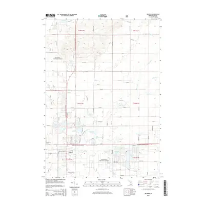
2014 Map of Baldwin
USGS Topo · Published 2014About this map
Baldwin serves as a central hub within the sprawling southern reaches of the Manistee National Forest, where a dense network of glacial lakes and tributaries defines the Lake County landscape. The area around Idlewild stands out as a significant cultural landmark, centered on Idlewild Lake and neighboring Paradise Lake. This region is characterized by its high density of named water bodies, including Leverentz Lake, Putman Lake, and the winding path of the Baldwin River. The transport network is anchored by US Hwy 10 and the Baldwin Municipal Airport, supporting the local economy and forest access. Significant local history sites such as Webber Cem and landmarks like Government Lake provide a detailed look at the geographic distribution of early 21st-century settlements and conservation lands within the forest's boundaries.
Find a feature on this map
71 named features on this map. Tap any name to fly to it.
Don’t see what you’re looking for? This feature index may not catch every label — zoom into the map to look around manually.
Map Details
Editions of this 2014 Baldwin Map
This is the sole edition of this map. No revisions or reprints were ever made.
Other maps of this area

1931 · Baldwin NW
USGS Topo · 1:31,680

1931 · Baldwin NE
USGS Topo · 1:31,680

1932 · Chase NW
USGS Topo · 1:31,680

1933 · Peacock SE
USGS Topo · 1:31,680

1933 · Peacock SW
USGS Topo · 1:31,680

1933 · Luther SW
USGS Topo · 1:31,680

1954 · Traverse City
USGS Topo · 1:250,000

1954 · Midland
USGS Topo · 1:250,000

1957 · Luther
USGS Topo · 1:62,500

1957 · Wellston
USGS Topo · 1:62,500