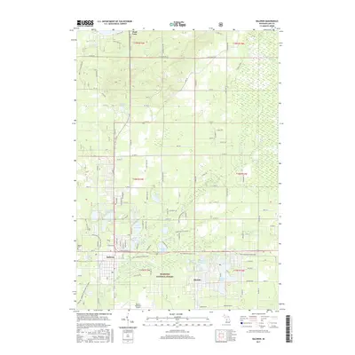
2017 Map of Baldwin
USGS Topo · Published 2017About this map
Baldwin serves as a central hub within the Manistee National Forest, where the landscape is defined by a dense network of water bodies and recreational trails. This 2017 survey shows the transition from the developed streets of Idlewild and the village of Baldwin into the surrounding woodlands and wetlands like Carpenter Marsh. The presence of the Baldwin Municipal Airport south of town and the Webber Cem to the west provides specific points of interest for local history and genealogy.
Find a feature on this map
112 named features on this map. Tap any name to fly to it.
Don’t see what you’re looking for? This feature index may not catch every label — zoom into the map to look around manually.
Map Details
Editions of this 2017 Baldwin Map
This is the sole edition of this map. No revisions or reprints were ever made.
Other maps of this area

1931 · Baldwin NW
USGS Topo · 1:31,680

1931 · Baldwin NE
USGS Topo · 1:31,680

1932 · Chase NW
USGS Topo · 1:31,680

1933 · Peacock SE
USGS Topo · 1:31,680

1933 · Peacock SW
USGS Topo · 1:31,680

1933 · Luther SW
USGS Topo · 1:31,680

1954 · Traverse City
USGS Topo · 1:250,000

1954 · Midland
USGS Topo · 1:250,000

1957 · Luther
USGS Topo · 1:62,500

1957 · Wellston
USGS Topo · 1:62,500