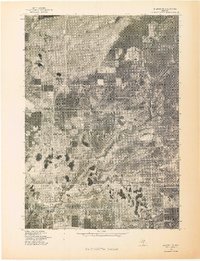
1976 Map of Baldwin NE
USGS Topo · Published 1976About this map
Idlewild and the eastern outskirts of Baldwin are documented here in a 1976 orthophotograph produced by the Geological Survey. This aerial perspective reveals the dense distribution of small glacial lakes and the intricate grid of residential streets that defined these Lake County communities during the mid-1970s. The imagery highlights the stark contrast between the structured forest management and the organic expansion of recreational properties around the various unnamed water bodies. This advance print provides a clear visual record of the land use patterns and road networks that supported these northern Michigan resort destinations before late-century development further altered the landscape.
Find a feature on this map
2 named features on this map. Tap any name to fly to it.
Don’t see what you’re looking for? This feature index may not catch every label — zoom into the map to look around manually.
Map Details
Editions of this 1976 Baldwin NE Map
This is the sole edition of this map. No revisions or reprints were ever made.
Other maps of this area

1931 · Baldwin NW
USGS Topo · 1:31,680

1931 · Baldwin NE
USGS Topo · 1:31,680

1932 · Chase NW
USGS Topo · 1:31,680

1933 · Peacock SE
USGS Topo · 1:31,680

1933 · Peacock SW
USGS Topo · 1:31,680

1933 · Luther SW
USGS Topo · 1:31,680

1954 · Traverse City
USGS Topo · 1:250,000

1954 · Midland
USGS Topo · 1:250,000

1957 · Luther
USGS Topo · 1:62,500

1957 · Wellston
USGS Topo · 1:62,500