
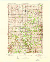
1949 Map of Baldwin
USGS Topo · Published 1949About this map
The Chicago And North Western railroad forms a vital transport spine through west-central Wisconsin, connecting the growing communities of Hammond, Baldwin, and Woodville. This mid-century landscape is defined by its deep commitment to local education and faith, evidenced by dozens of rural institutions such as the Birchdale Sch, Loyalty Sch, and Happy Valley Ch. The terrain transitions from the headwaters of the Kinnickinnic River in the northwest toward the more dissected valleys of the Rush River and its tributaries in the south.
Find a feature on this map
67 named features on this map. Tap any name to fly to it.
Don’t see what you’re looking for? This feature index may not catch every label — zoom into the map to look around manually.
Map Details
Editions of this 1949 Baldwin Map
2 editions found
Other maps of this area

1935 · Arkansaw
USGS Topo · 1:48,000

1940 · Maiden Rock
USGS Topo · 1:62,500

1941 · Arkansaw
USGS Topo · 1:62,500

1942 · Arkansaw
USGS Topo · 1:62,500

1944 · Red Wing
USGS Topo · 1:62,500

1946 · Knapp
USGS Topo · 1:62,500

1946 · River Falls
USGS Topo · 1:62,500

1948 · New Richmond
USGS Topo · 1:62,500

1948 · Downing
USGS Topo · 1:62,500

1949 · New Richmond
USGS Topo · 1:62,500