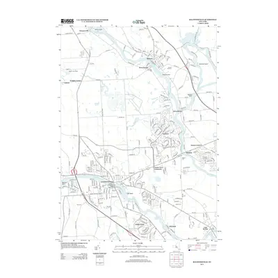
2013 Map of Baldwinsville
USGS Topo · Published 2013About this map
The confluence of the Oneida River and Seneca River forms the Oswego River at the aptly named Three Rivers, a central hydrological landmark in this 2013 survey. This aquatic junction anchors a landscape shaped by historical water transport and modern residential development, spanning the border of Oswego Co and Onondaga Co. The village of Baldwinsville and the town of Phoenix serve as major hubs, with the latter featuring the Phoenix Rural Cem and proximity to Treasure Island. Significant land-use patterns are visible in the planned Lysander New Community and the suburban layout of Radisson, illustrating the region's 21st-century growth. Genealogists can locate numerous burial grounds across the area, including Chase Cem near Chase Road and Riverside Cem along the Seneca. Industrial infrastructure is represented by the CSX rail line and the Seneca River Bridge, which facilitate movement through this river-connected corridor.
Find a feature on this map
239 named features on this map. Tap any name to fly to it.
Don’t see what you’re looking for? This feature index may not catch every label — zoom into the map to look around manually.
Map Details
Editions of this 2013 Baldwinsville Map
This is the sole edition of this map. No revisions or reprints were ever made.
Other maps of this area

1895 · Syracuse
USGS Topo · 1:62,500

1898 · Syracuse
USGS Topo · 1:62,500

1900 · Baldwinsville
USGS Topo · 1:62,500

1900 · Fulton
USGS Topo · 1:62,500

1905 · Mexico
USGS Topo · 1:62,500

1939 · Syracuse West
USGS Topo · 1:24,000

1940 · Brewerton
USGS Topo · 1:24,000

1943 · Jordan
USGS Topo · 1:31,680

1943 · Lysander
USGS Topo · 1:31,680

1943 · Brewerton
USGS Topo · 1:31,680