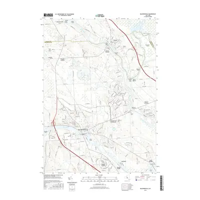
2016 Map of Baldwinsville
USGS Topo · Published 2016About this map
Baldwinsville anchors the southern portion of this landscape where the Seneca River flows through a series of islands including Fobes Island and Maloney Island. This 2016 survey documents a complex network of waterways, centered on the confluence of the Oswego River, Oneida River, and Seneca River at the appropriately named Three Rivers. The area transitions from the more densely settled villages of Phoenix and West Phoenix in the north to residential developments like Seneca Knolls and Village Green further south.
Find a feature on this map
182 named features on this map. Tap any name to fly to it.
Don’t see what you’re looking for? This feature index may not catch every label — zoom into the map to look around manually.
Map Details
Editions of this 2016 Baldwinsville Map
This is the sole edition of this map. No revisions or reprints were ever made.
Other maps of this area

1895 · Syracuse
USGS Topo · 1:62,500

1898 · Syracuse
USGS Topo · 1:62,500

1900 · Baldwinsville
USGS Topo · 1:62,500

1900 · Fulton
USGS Topo · 1:62,500

1905 · Mexico
USGS Topo · 1:62,500

1939 · Syracuse West
USGS Topo · 1:24,000

1940 · Brewerton
USGS Topo · 1:24,000

1943 · Jordan
USGS Topo · 1:31,680

1943 · Lysander
USGS Topo · 1:31,680

1943 · Brewerton
USGS Topo · 1:31,680