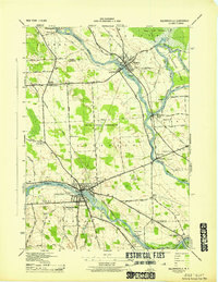
1943 Map of Baldwinsville
USGS Topo · Published 1943About this map
The confluence of the Seneca River and Oneida River at Three Rivers anchor this 1943 survey, a landscape defined by the convergence of major New York waterways and the State Barge Canal. Central to the map is the industrial and residential core of Baldwinsville, where the canal and river systems intersect. The interior reflects an earlier rural organization, with numerous numbered schoolhouses like School No 14 and School No 7 serving small crossroads communities such as Belgium and Moyers Corners.
Find a feature on this map
56 named features on this map. Tap any name to fly to it.
Don’t see what you’re looking for? This feature index may not catch every label — zoom into the map to look around manually.
Map Details
Editions of this 1943 Baldwinsville Map
This is the sole edition of this map. No revisions or reprints were ever made.
Other maps of this area

1895 · Syracuse
USGS Topo · 1:62,500

1898 · Syracuse
USGS Topo · 1:62,500

1900 · Baldwinsville
USGS Topo · 1:62,500

1900 · Fulton
USGS Topo · 1:62,500

1905 · Mexico
USGS Topo · 1:62,500

1939 · Syracuse West
USGS Topo · 1:24,000

1940 · Brewerton
USGS Topo · 1:24,000

1943 · Jordan
USGS Topo · 1:31,680

1943 · Lysander
USGS Topo · 1:31,680

1943 · Brewerton
USGS Topo · 1:31,680