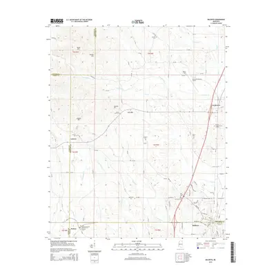
2015 Map of Baldwyn
USGS Topo · Published 2015About this map
The boundary lines of Tippah, Union, Prentiss, and Lee counties converge across this Northeast Mississippi landscape, anchored by the community of Baldwyn. The terrain is defined by the high ground of the Tippah Hills, with prominent peaks like Kitchen Mtn and Geeville Mtn rising above the surrounding creek bottoms. To the west, the Brices Crossroads National Battlefield Cem stands as a significant landmark, marking the site of a major Civil War engagement nearby.
Find a feature on this map
110 named features on this map. Tap any name to fly to it.
Don’t see what you’re looking for? This feature index may not catch every label — zoom into the map to look around manually.
Map Details
Editions of this 2015 Baldwyn Map
This is the sole edition of this map. No revisions or reprints were ever made.
Other maps of this area

1921 · Booneville
USGS Topo · 1:48,000

1921 · Tupelo
USGS Topo · 1:48,000

1922 · Booneville
USGS Topo · 1:62,500

1923 · Tupelo
USGS Topo · 1:62,500

1955 · Ripley
USGS Topo · 1:62,500

1955 · Sherman
USGS Topo · 1:62,500

1956 · Tupelo
USGS Topo · 1:250,000

1958 · Tupelo
USGS Topo · 1:250,000

1972 · Jumpertown
USGS Topo · 1:24,000

1973 · Guntown
USGS Topo · 1:24,000