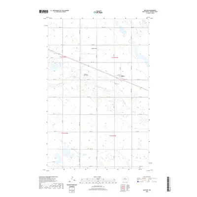
2020 Map of Balfour
USGS Topo · Published 2020About this map
Balfour anchors this McHenry County landscape, situated where the high ground of Hogback Ridge gives way to the broad Wintering River Flats. The town's grid is defined by historical thoroughfares like Sahr Ave and Railroad Ave, reflecting its alignment with the regional transport corridors of central North Dakota. Beyond the settlement, the Wintering River meanders through the prairie, creating a distinct topographical break in the surrounding township sections. Genealogists and local historians can find the Balfour Cem located just southwest of the town center. The map reveals the precise layout of the rural road system, from Central Ave N to numerous numbered section lines, illustrating the enduring agricultural organization of this high plains region in the modern era.
Find a feature on this map
36 named features on this map. Tap any name to fly to it.
Don’t see what you’re looking for? This feature index may not catch every label — zoom into the map to look around manually.
Map Details
Editions of this 2020 Balfour Map
This is the sole edition of this map. No revisions or reprints were ever made.
Other maps of this area

1929 · Balfour
USGS Topo · 1:62,500

1930 · Drake
USGS Topo · 1:62,500

1954 · Minot
USGS Topo · 1:250,000

1954 · McClusky
USGS Topo · 1:250,000

1957 · Bergen
USGS Topo · 1:24,000

1957 · Karlsruhe
USGS Topo · 1:24,000

1957 · Rangeley
USGS Topo · 1:24,000

1958 · McClusky
USGS Topo · 1:250,000

1958 · Minot
USGS Topo · 1:250,000

1958 · Butte
USGS Topo · 1:24,000