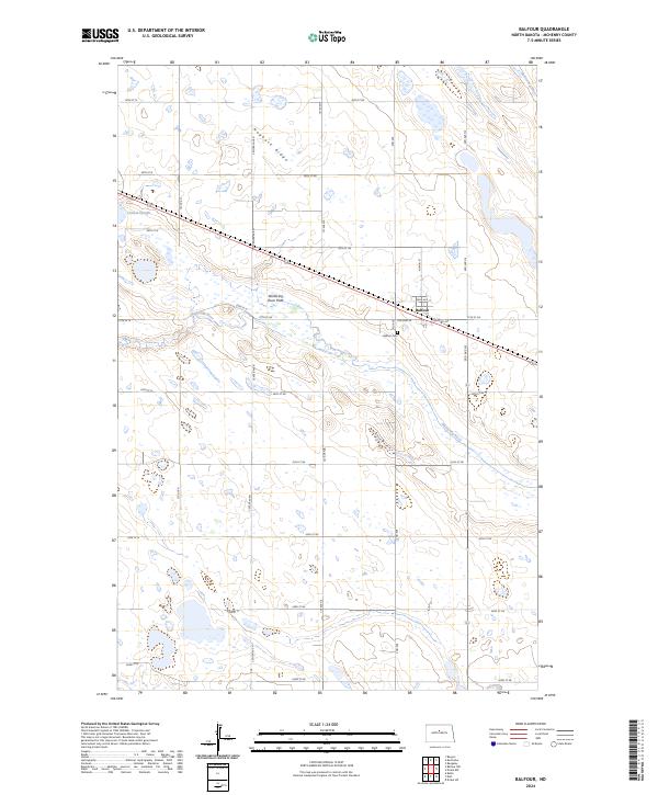
2024 Map of Balfour
USGS Topo · Published 2024About this map
Balfour sits at the heart of this McHenry County landscape, oriented around a street grid that includes Railroad Ave and Sahr Ave. The town's historical geography is further anchored by the Balfour Cem to the south. The surrounding terrain is defined by the winding course of the Wintering River, which creates distinctive wetland environments such as the Wintering River Flats and Connia Slough. These hydrologic features contribute to a landscape dominated by conservation, notably the McHenry County Waterfowl Production Area. To the northwest, Hogback Ridge provides a break in the glacial drift plain. The map reveals the classic prairie township structure, with section lines marked by roads like Old Hwy 52 and a dense network of numbered range roads.
Find a feature on this map
31 named features on this map. Tap any name to fly to it.
Don’t see what you’re looking for? This feature index may not catch every label — zoom into the map to look around manually.
Map Details
Editions of this 2024 Balfour Map
This is the sole edition of this map. No revisions or reprints were ever made.
Other maps of this area

1929 · Balfour
USGS Topo · 1:62,500

1930 · Drake
USGS Topo · 1:62,500

1954 · Minot
USGS Topo · 1:250,000

1954 · McClusky
USGS Topo · 1:250,000

1957 · Bergen
USGS Topo · 1:24,000

1957 · Karlsruhe
USGS Topo · 1:24,000

1957 · Rangeley
USGS Topo · 1:24,000

1958 · McClusky
USGS Topo · 1:250,000

1958 · Minot
USGS Topo · 1:250,000

1958 · Butte
USGS Topo · 1:24,000