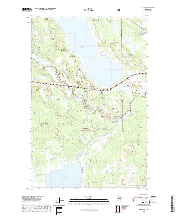
2022 Map of Ball Club
USGS Topo · Published 2022About this map
The settlement of Ball Club sits at the northern edge of the Chippewa National Forest, occupying a hydrologically complex landscape where the Mississippi River meanders toward its confluence with the Ball Club River. This 2022 survey details the intricate wetlands and waterways of Itasca and Cass Counties, including the expansive Ball Club Lake and the southern Mud Lake. The map is particularly useful for genealogical research, identifying several distinct burial sites such as the Lindenwood - Independent Apostolic Lutheran Cem and Tibbetts Cem. The terrain is marked by seasonal watercourses like Shaggy Brook and Snake Creek, alongside significant landmarks such as Gamblers Point. A dense network of forest roads and county routes, including Co Rd 143 and Forest Rte 2127, provides access to the timberlands and shorelines that define this Northwoods region.
Find a feature on this map
38 named features on this map. Tap any name to fly to it.
Don’t see what you’re looking for? This feature index may not catch every label — zoom into the map to look around manually.
Map Details
Editions of this 2022 Ball Club Map
This is the sole edition of this map. No revisions or reprints were ever made.
Other maps of this area

1954 · Bemidji
USGS Topo · 1:250,000

1954 · Hibbing
USGS Topo · 1:250,000

1957 · Bemidji
USGS Topo · 1:250,000

1957 · Hibbing
USGS Topo · 1:250,000

1958 · Bemidji
USGS Topo · 1:250,000

1958 · Hibbing
USGS Topo · 1:250,000

1964 · Hibbing
USGS Topo · 1:250,000

1970 · Deer River NE
USGS Topo · 1:24,000
1970 · Deer River
USGS Topo · 1:24,000

1970 · Ball Club
USGS Topo · 1:24,000