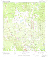
1972 Map of Ball
USGS Topo · Published 1974About this map
Camp Beauregard and the surrounding woodlands of the Kisatchie National Forest define the landscape of northern Rapides Parish during the early 1970s. The map illustrates a transition from the dense pine forests of the north to the growing settlements of Tioga and Paradise in the south. The dual presence of the Missouri Pacific and Kansas City Southern railroads underscores the region's historical reliance on rail for both military logistics and the timber industry. Small rural communities like Stay and Simms remain visible alongside several local landmarks, including the Pollock Municipal Airport and the State Industrial Sch. Numerous country churches and cemeteries, such as Corinth Ch, Sardis Ch, and Venus Cem, provide essential anchor points for genealogists and local historians tracing the social fabric of this central Louisiana corridor.
Find a feature on this map
45 named features on this map. Tap any name to fly to it.
Don’t see what you’re looking for? This feature index may not catch every label — zoom into the map to look around manually.
Map Details
Editions of this 1972 Ball Map
2 editions found
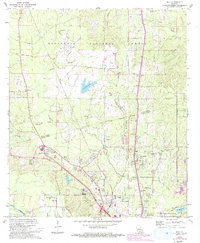
Other maps of this area

1932 · Boyce NE
USGS Topo · 1:31,680

1932 · Colfax SE
USGS Topo · 1:31,680

1936 · Colfax
USGS Topo · 1:62,500

1936 · Pollock
USGS Topo · 1:62,500

1941 · Alexandria
USGS Topo · 1:62,500

1941 · Pollock
USGS Topo · 1:62,500

1941 · Boyce
USGS Topo · 1:62,500

1945 · Boyce SE
USGS Topo · 1:31,680

1949 · Boyce SE
USGS Topo · 1:31,680

1953 · Alexandria
USGS Topo · 1:250,000