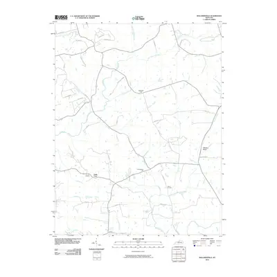
2010 Map of Ballardsville
USGS Topo · Published 2010About this map
Floyds Fork and its numerous tributaries, including Lick Fork, Fibles Run, and Lutz Run, define the drainage patterns of this Oldham County landscape. The area is characterized by small, established settlements like Todds Point and Chestnut Grove, connected by a network of rural roads such as Hinkle Ln and Dover Rd. The terrain is marked by prominent elevations like Gathright Hill and Lincolnfellow Hill, which overlook a mix of agricultural plots and wooded creek bottoms. For those tracing local history or family lineage, the presence of several burial sites, including Fairview Cemetery, Hebron Cemetery, and Antioch Cemetery, provides specific points of reference for the community's ancestral footprint. The map also captures the headwaters of Bullskin Creek and Fox Run, illustrating the intricate water system that has influenced land use and property boundaries in this part of Kentucky for generations.
Find a feature on this map
44 named features on this map. Tap any name to fly to it.
Don’t see what you’re looking for? This feature index may not catch every label — zoom into the map to look around manually.
Map Details
Editions of this 2010 Ballardsville Map
This is the sole edition of this map. No revisions or reprints were ever made.
Other maps of this area

1923 · Waddy
USGS Topo · 1:48,000

1925 · Mount Eden
USGS Topo · 1:48,000

1927 · Mount Eden
USGS Topo · 1:62,500

1928 · New Castle
USGS Topo · 1:48,000

1929 · Taylorsville
USGS Topo · 1:62,500

1932 · New Castle
USGS Topo · 1:62,500

1932 · La Grange
USGS Topo · 1:62,500

1951 · Crestwood
USGS Topo · 1:24,000

1951 · Fisherville
USGS Topo · 1:24,000

1954 · Ballardsville
USGS Topo · 1:24,000