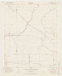
1943 Map of Ballinger Canyon
USGS Topo · Published 1969About this map
Klipstein Ranch and Camp Dix anchor this remote landscape in the early 1940s, situated where the borders of Kern, San Luis Obispo, Santa Barbara, and Ventura counties converge. The terrain is defined by the sharp descent from the northern reaches of the Los Padres National Forest into the Cuyama Valley, a transition marked by several named peaks including Padrone, Pattiway, and Pelato. Waterways like Bitterwater Creek and the deep Cienaga Canyon carve through the arid environment, illustrating the drainage patterns that shaped local ranching and settlement. The map provides a distinct view of the region's complex topography before modern infrastructure, including prominent geological markers like the Fault and Erosion peaks that stand above the winding Bitter Creek.
Find a feature on this map
22 named features on this map. Tap any name to fly to it.
Don’t see what you’re looking for? This feature index may not catch every label — zoom into the map to look around manually.
Map Details
Editions of this 1943 Ballinger Canyon Map
4 editions found
Other maps of this area

1902 · Santa Ynez
USGS Topo · 1:125,000

1903 · Mt. Pinos
USGS Topo · 1:125,000

1905 · Santa Ynez
USGS Topo · 1:125,000

1910 · Buena Vista Lake
USGS Topo · 1:125,000

1912 · McKittrick
USGS Topo · 1:125,000

1912 · Buena Vista Lake
USGS Topo · 1:125,000

1931 · Pentland Junction
USGS Topo · 1:31,680

1934 · Pentland
USGS Topo · 1:31,680

1942 · Ballinger Canyon
USGS Topo · 1:24,000

1942 · East of Cuyama Ranch
USGS Topo · 1:24,000