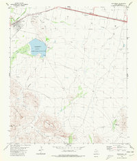
1980 Map of Balmorhea
USGS Topo · Published 1980About this map
The town of Balmorhea and the neighboring settlement of Brogado anchor this 1980 study of the Trans-Pecos landscape. The area is defined by a complex irrigation network, including the Main Canal, Madera Canal, and Diversion Canal, which manage water flow from Toyah Creek toward the agricultural fields and Balmorhea Lake. This desert oasis character is contrasted sharply by the rising elevations of the Barrilla Mountains to the south, where Saddle Back Mountain and Elkins Hills overlook deep seasonal drainages like Kountz Draw and Paloma Draw.
Find a feature on this map
29 named features on this map. Tap any name to fly to it.
Don’t see what you’re looking for? This feature index may not catch every label — zoom into the map to look around manually.
Map Details
Editions of this 1980 Balmorhea Map
This is the sole edition of this map. No revisions or reprints were ever made.
Other maps of this area

1894 · Fort Davis
USGS Topo · 1:125,000

1897 · Fort Davis
USGS Topo · 1:125,000

1921 · Toyah
USGS Topo · 1:125,000

1954 · Pecos
USGS Topo · 1:250,000

1954 · Fort Stockton
USGS Topo · 1:250,000

1955 · Saragosa
USGS Topo · 1:62,500

1957 · Pecos
USGS Topo · 1:250,000

1958 · Fort Stockton
USGS Topo · 1:250,000
1970 · Verhalen South
USGS Topo · 1:24,000
1970 · Saragosa
USGS Topo · 1:24,000