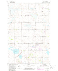
1958 Map of Balta
USGS Topo · Published 1980About this map
Balta and its surrounding Pierce County prairies are documented here following a 1950s field check, showing a landscape defined by small-town infrastructure and rural education. The village of Balta sits centrally along the rail line, bordered to the south by the Balta Game Management Area. This agricultural region preserves several family-oriented and community landmarks, including Brazil Sch No 2 and Brazil Sch No 3, which reflect the historical density of school districts in Tuscarora and Jefferson townships.
Find a feature on this map
12 named features on this map. Tap any name to fly to it.
Don’t see what you’re looking for? This feature index may not catch every label — zoom into the map to look around manually.
Map Details
Editions of this 1958 Balta Map
2 editions found
Other maps of this area

1953 · Devils Lake
USGS Topo · 1:250,000

1954 · Tunbridge
USGS Topo · 1:24,000

1954 · Berwick
USGS Topo · 1:24,000

1954 · Minot
USGS Topo · 1:250,000

1955 · Rugby
USGS Topo · 1:24,000

1956 · Devils Lake
USGS Topo · 1:250,000

1958 · Minot
USGS Topo · 1:250,000

1958 · Balta SE
USGS Topo · 1:24,000
1958 · Balta NW
USGS Topo · 1:24,000

1958 · Balta
USGS Topo · 1:24,000