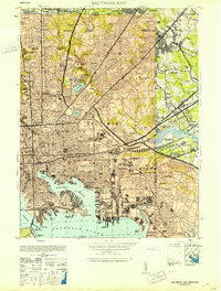
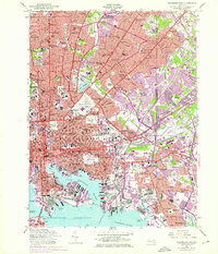
1953 Map of Baltimore East
USGS Topo · Published 1953About this map
Fort McHenry stands at the tip of Whetstone Point, guarding the entrance to the Northwest Branch and the industrial heart of the city in the early 1950s. The landscape is a dense assembly of urban neighborhoods, rail yards like the Canton Yard, and institutional anchors including Johns Hopkins University and the Johns Hopkins Hospital. This era shows the city's complex infrastructure in full operation, from the Montebello Filters and City Water Works to the heavy transit hubs at Camden Station and Union Station. To the east, the transition from urban core to industrial outskirts is marked by Camp Holabird and the expansion of Dundalk near Colgate Creek. Large green spaces like Patterson Park and Clifton Park provide a clear contrast to the surrounding grid of rowhouses and the sprawling rail corridors of the B & O and Pennsylvania lines.
Find a feature on this map
138 named features on this map. Tap any name to fly to it.
Don’t see what you’re looking for? This feature index may not catch every label — zoom into the map to look around manually.
Map Details
Editions of this 1953 Baltimore East Map
5 editions found
Other maps of this area

1893 · North Point
USGS Topo · 1:62,500

1893 · Gunpowder
USGS Topo · 1:62,500

1894 · Baltimore
USGS Topo · 1:62,500

1894 · Relay
USGS Topo · 1:62,500

1898 · Tolchester
USGS Topo · 1:125,000

1899 · Baltimore
USGS Topo · 1:62,500

1901 · Gunpowder
USGS Topo · 1:62,500

1903 · Tolchester
USGS Topo · 1:125,000

1904 · Baltimore
USGS Topo · 1:62,500

1904 · North Point
USGS Topo · 1:62,500