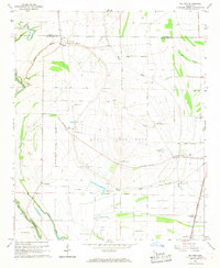
1966 Map of Baltzer
USGS Topo · Published 1967About this map
The State Penal Farm dominates the central landscape of this Sunflower County survey, defined by a massive circular arrangement of field lines and a series of numbered outposts ranging from Camp No 2 to Camp No 12. This distinctive land-use pattern, encircled by a Penal Farm Boundary, reflects the specialized agricultural economy of the mid-20th-century Mississippi Delta. Beyond the farm perimeter, the map documents small communities like Baltzer and Lombardy, alongside the extensive Goldfield Plantation to the south.
Find a feature on this map
40 named features on this map. Tap any name to fly to it.
Don’t see what you’re looking for? This feature index may not catch every label — zoom into the map to look around manually.
Map Details
Editions of this 1966 Baltzer Map
This is the sole edition of this map. No revisions or reprints were ever made.
Other maps of this area

1931 · Sumner
USGS Topo · 1:48,000

1931 · Drew
USGS Topo · 1:48,000

1932 · Tutwiler
USGS Topo · 1:48,000

1935 · Clarksdale
USGS Topo · 1:62,500

1935 · Sumner
USGS Topo · 1:62,500

1935 · Tutwiler
USGS Topo · 1:62,500

1935 · Mound Bayou
USGS Topo · 1:62,500

1939 · Sumner
USGS Topo · 1:62,500

1939 · Tutwiler
USGS Topo · 1:62,500

1939 · Clarksdale
USGS Topo · 1:62,500