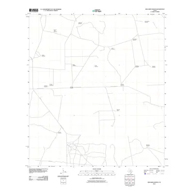
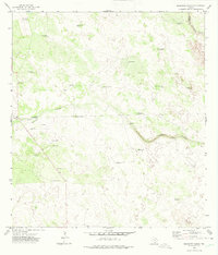
2010 Map of Baluarte Ranch
USGS Topo · Published 2010About this map
Baluarte Ranch serves as the central landmark in this ranching landscape of Jim Hogg County, characterized by a sparse network of roads and essential water infrastructure. The distribution of named windmills across the terrain, such as Buenos Aires Windmill, Los Caballos Windmill, and Coyotes Windmill, underscores the critical role of groundwater in supporting livestock in this arid South Texas region. The physical geography is defined by subtle drainage features like Polo Blanco Creek and Arroyo los Palos. Transportation is limited to a few arterial routes, including FM 1017 and Baluarte Ranch Rd, which connect the isolated ranching operations. The naming conventions of the water points, from ChiliPitien Windmill to Ormigas Windmill, reflect the cultural heritage and land-use history of these expansive cattle holdings.
Find a feature on this map
22 named features on this map. Tap any name to fly to it.
Don’t see what you’re looking for? This feature index may not catch every label — zoom into the map to look around manually.
Map Details
Editions of this 2010 Baluarte Ranch Map
This is the sole edition of this map. No revisions or reprints were ever made.
Other maps of this area

1921 · Falfurrias
USGS Topo · 1:125,000

1956 · Laredo
USGS Topo · 1:250,000

1967 · Hebbronville SE
USGS Topo · 1:24,000

1967 · Hebbronville
USGS Topo · 1:24,000

1968 · Palomas Ranch NW
USGS Topo · 1:24,000

1968 · Palomas Ranch SW
USGS Topo · 1:24,000
1969 · Ramirez
USGS Topo · 1:24,000
1972 · Alta Vista Ranch SW
USGS Topo · 1:24,000
1972 · Alta Vista Ranch
USGS Topo · 1:24,000
1972 · Baluarte Ranch
USGS Topo · 1:24,000