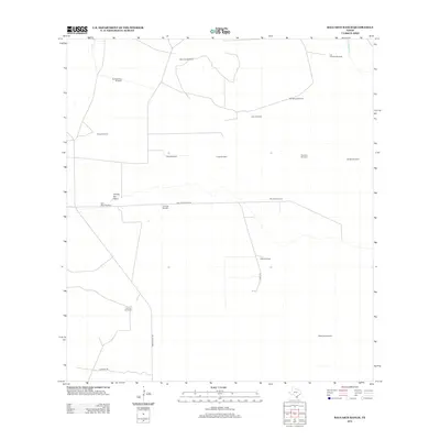
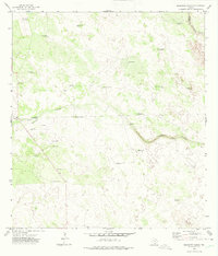
2013 Map of Baluarte Ranch
USGS Topo · Published 2013About this map
Baluarte Ranch anchors this portion of Jim Hogg County, illustrating a landscape defined by ranching infrastructure and seasonal water sources. The map reveals an extensive network of named windmills, such as Jaboncillo Windmill, Los Caballos Windmill, and Buenos Aires Windmill, which serve as critical landmarks in this arid South Texas region. These features, along with names like Chili Pitien Windmill and Ormigas Windmill, speak to the localized nomenclature of the cattle industry.
Find a feature on this map
22 named features on this map. Tap any name to fly to it.
Don’t see what you’re looking for? This feature index may not catch every label — zoom into the map to look around manually.
Map Details
Editions of this 2013 Baluarte Ranch Map
This is the sole edition of this map. No revisions or reprints were ever made.
Other maps of this area

1921 · Falfurrias
USGS Topo · 1:125,000

1956 · Laredo
USGS Topo · 1:250,000

1967 · Hebbronville SE
USGS Topo · 1:24,000

1967 · Hebbronville
USGS Topo · 1:24,000

1968 · Palomas Ranch NW
USGS Topo · 1:24,000

1968 · Palomas Ranch SW
USGS Topo · 1:24,000
1969 · Ramirez
USGS Topo · 1:24,000
1972 · Alta Vista Ranch SW
USGS Topo · 1:24,000
1972 · Alta Vista Ranch
USGS Topo · 1:24,000
1972 · Baluarte Ranch
USGS Topo · 1:24,000