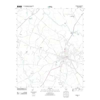
2011 Map of Bamberg
USGS Topo · Published 2011About this map
Bamberg serves as the central hub of this South Carolina landscape, where the local street grid intersects with regional routes near the Bamberg Post Office. The town is surrounded by a network of creeks and branches, including Lemon Creek and Halfmoon Branch, which drain toward the prominent South Fork Edisto River to the north. This river corridor is marked by several access points such as Bobcat Landing, Roberts Swamp Landing, and Stares Lake Landing, highlighting the importance of the waterway to the area's geography.
Find a feature on this map
94 named features on this map. Tap any name to fly to it.
Don’t see what you’re looking for? This feature index may not catch every label — zoom into the map to look around manually.
Map Details
Editions of this 2011 Bamberg Map
This is the sole edition of this map. No revisions or reprints were ever made.
Other maps of this area

1919 · Olar
USGS Topo · 1:62,500

1919 · Bamberg
USGS Topo · 1:48,000

1919 · Lodge
USGS Topo · 1:62,500

1920 · Lodge
USGS Topo · 1:48,000

1920 · Bamberg
USGS Topo · 1:62,500

1920 · Orangeburg
USGS Topo · 1:48,000

1921 · Orangeburg
USGS Topo · 1:62,500

1921 · Lodge
USGS Topo · 1:62,500

1943 · Olar
USGS Topo · 1:62,500

1943 · Lodge
USGS Topo · 1:62,500