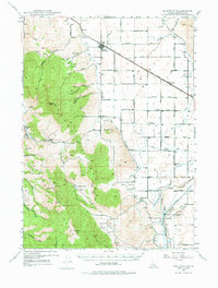
1948 Map of Bancroft
USGS Topo · Published 1975About this map
Bancroft and the Gentile Valley define this late 1940s landscape, where the Union Pacific (Oregon Short Line) cuts across the northern plains. This area is a complex network of agricultural irrigation and hydroelectric power generation, evidenced by the intricate system of the Gentile Valley Canal, Soda Canal, and Lloyd Canal. In the south, the Bear River powers the Grace Power Plant and Cove Power Plant, supported by visible surge tanks and penstocks.
Find a feature on this map
70 named features on this map. Tap any name to fly to it.
Don’t see what you’re looking for? This feature index may not catch every label — zoom into the map to look around manually.
Map Details
Editions of this 1948 Bancroft Map
2 editions found
Other maps of this area

1914 · Henry
USGS Topo · 1:48,000

1915 · Preston
USGS Topo · 1:96,000

1916 · Henry
USGS Topo · 1:62,500

1917 · Portneuf
USGS Topo · 1:62,500

1918 · Preston
USGS Topo · 1:125,000

1948 · Bancroft
USGS Topo · 1:62,500

1948 · Soda Springs
USGS Topo · 1:62,500

1949 · Bancroft
USGS Topo · 1:62,500

1949 · Soda Springs
USGS Topo · 1:62,500

1954 · Pocatello
USGS Topo · 1:250,000