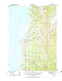
1943 Map of Bandon
USGS Topo · Published 1963About this map
The Coquille River serves as the central artery for this coastal landscape during the early 1940s, winding past small riverbank settlements and providing the primary transit route for the region's timber and maritime interests. Near the mouth of the river, the Coquille River L H stands watch over the Pacific at Coquille Pt, while a Ferry still connects the north and south banks near Bandon. The map documents a period of resource extraction along the coast, evidenced by the Seven Devils Mine and several sites marked as Reagle Mine Abandoned and Pioneer Mine Abandoned.
Find a feature on this map
72 named features on this map. Tap any name to fly to it.
Don’t see what you’re looking for? This feature index may not catch every label — zoom into the map to look around manually.
Map Details
Editions of this 1943 Bandon Map
3 editions found
Other maps of this area

1896 · Coos Bay
USGS Topo · 1:125,000

1898 · Coos Bay
USGS Topo · 1:125,000

1899 · Port Orford
USGS Topo · 1:125,000

1900 · Coos Bay
USGS Topo · 1:125,000

1903 · Port Orford
USGS Topo · 1:125,000

1942 · Empire
USGS Topo · 1:62,500

1942 · Coquille
USGS Topo · 1:62,500

1942 · Coos Bay
USGS Topo · 1:62,500

1943 · Bandon
USGS Topo · 1:62,500

1944 · Empire
USGS Topo · 1:62,500