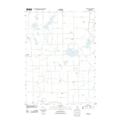
2011 Map of Banfield
USGS Topo · Published 2011About this map
Fine Lake and the settlement of Banfield anchor this portion of Barry County, a landscape defined by an intricate network of glacial lakes and small drainage systems. The survey illustrates a rural community structured around agriculture and recreation, with Maple Hills Golf Course and several large water bodies like Fair Lake and Stony Lake characterizing the northern and southern reaches. Genealogy researchers will find significant value in the documentation of several local burial grounds, including Banfield Cemetery, Hickory Corners Cemetery, and the Day Cemetery, which are scattered throughout the township. The hydrology is dominated by Augusta Creek and Sevenmile Creek, which weave through the terrain, connecting smaller ponds and marshes such as School Pond and Mud Lake. This 2011 edition provides a precise view of the road network, from named local routes like Bristol Rd to small residential lanes bordering the lakeshores.
Find a feature on this map
99 named features on this map. Tap any name to fly to it.
Don’t see what you’re looking for? This feature index may not catch every label — zoom into the map to look around manually.
Map Details
Editions of this 2011 Banfield Map
This is the sole edition of this map. No revisions or reprints were ever made.
Other maps of this area

1918 · Battle Creek
USGS Topo · 1:62,500

1918 · Galesburg
USGS Topo · 1:62,500

1943 · Battle Creek
USGS Topo · 1:62,500

1944 · Galesburg
USGS Topo · 1:62,500

1947 · Augusta
USGS Topo · 1:24,000

1947 · Delton
USGS Topo · 1:24,000

1947 · Galesburg
USGS Topo · 1:24,000

1947 · Banfield
USGS Topo · 1:24,000

1947 · Bedford
USGS Topo · 1:24,000

1947 · Battle Creek
USGS Topo · 1:24,000