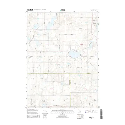
2014 Map of Banfield
USGS Topo · Published 2014About this map
Fine Lake and the surrounding glaciated landscape of southern Michigan define this survey, where the borders of Barry, Kalamazoo, and Calhoun counties intersect. The settlement patterns are anchored by Hickory Corners in the west and Banfield in the east, connected by a network of rural routes like W Hickory Rd and W Bristol Rd. This region is particularly dense with kettle lakes and wetlands, including Gilkey Lake, Fair Lake, and Hamilton Lake, many of which feed into the winding course of Augusta Creek. The map provides excellent detail for genealogical research, locating several established burial grounds such as Hickory Corners Cemetery and Day Cemetery. This terrain, characterized by its numerous small basins and drainage systems like Sevenmile Creek, illustrates the enduring rural character of the tri-county border area.
Find a feature on this map
105 named features on this map. Tap any name to fly to it.
Don’t see what you’re looking for? This feature index may not catch every label — zoom into the map to look around manually.
Map Details
Editions of this 2014 Banfield Map
This is the sole edition of this map. No revisions or reprints were ever made.
Other maps of this area

1918 · Battle Creek
USGS Topo · 1:62,500

1918 · Galesburg
USGS Topo · 1:62,500

1943 · Battle Creek
USGS Topo · 1:62,500

1944 · Galesburg
USGS Topo · 1:62,500

1947 · Augusta
USGS Topo · 1:24,000

1947 · Delton
USGS Topo · 1:24,000

1947 · Galesburg
USGS Topo · 1:24,000

1947 · Banfield
USGS Topo · 1:24,000

1947 · Bedford
USGS Topo · 1:24,000

1947 · Battle Creek
USGS Topo · 1:24,000