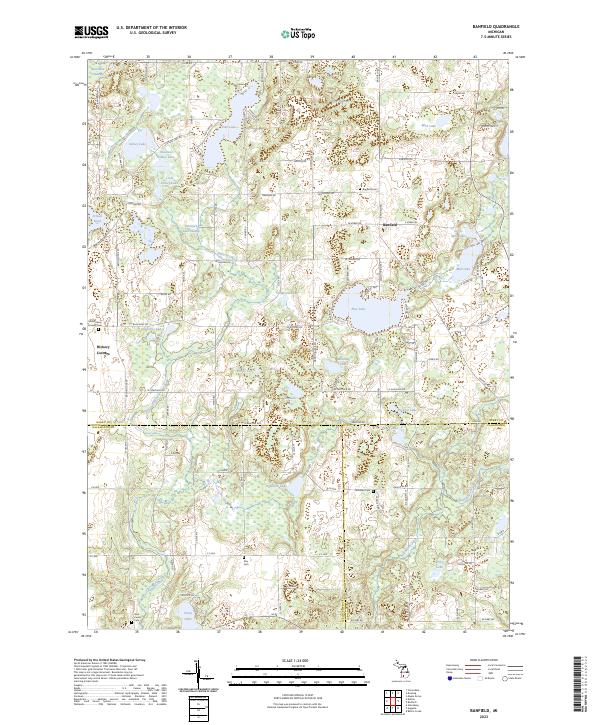
2023 Map of Banfield
USGS Topo · Published 2023About this map
Banfield and Hickory Corners anchor this landscape where three counties meet, showing a complex network of glacial kettle lakes and marshlands. The intersection of Barry, Kalamazoo, and Calhoun counties creates a diverse geography of water bodies ranging from the expansive Fine Lake with its central Indian Isle to smaller basins like Strewins Lake and Pickliss Lake. The terrain is deeply influenced by drainage patterns, with Augusta Creek winding through the west and Sevenmile Creek in the south, connecting various wetlands such as Blackman Swamp and Long Swamp.
Find a feature on this map
120 named features on this map. Tap any name to fly to it.
Don’t see what you’re looking for? This feature index may not catch every label — zoom into the map to look around manually.
Map Details
Editions of this 2023 Banfield Map
This is the sole edition of this map. No revisions or reprints were ever made.
Other maps of this area

1918 · Battle Creek
USGS Topo · 1:62,500

1918 · Galesburg
USGS Topo · 1:62,500

1943 · Battle Creek
USGS Topo · 1:62,500

1944 · Galesburg
USGS Topo · 1:62,500

1947 · Augusta
USGS Topo · 1:24,000

1947 · Delton
USGS Topo · 1:24,000

1947 · Galesburg
USGS Topo · 1:24,000

1947 · Banfield
USGS Topo · 1:24,000

1947 · Bedford
USGS Topo · 1:24,000

1947 · Battle Creek
USGS Topo · 1:24,000