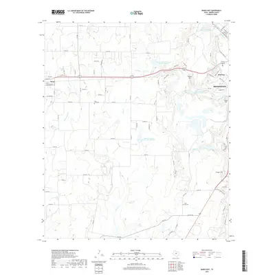
2019 Map of Bangs East
USGS Topo · Published 2019About this map
The town of Bangs and the western edge of Brownwood anchor this landscape in Brown County, where the transition from municipal outskirts to rural ranchland is defined by a network of seasonal watercourses. The local hydrology is heavily managed through a series of reservoirs, including Soil Conservation Service Site 5 Reservoir and Soil Conservation Service Site 2 Reservoir, reflecting the region's historical efforts to control runoff and secure water for agriculture. For genealogists and local historians, the map preserves the location of Clear Creek Cem and Cedar Point Cem, two essential landmarks for tracing family roots in this part of Texas. Natural landmarks like Round Mtn and Krueger Hill rise above the drainage basins of Clear Cr and Willis Cr, while the Brownwood Water Supply Canal illustrates the infrastructure required to support the growing community of Bluff View.
Find a feature on this map
85 named features on this map. Tap any name to fly to it.
Don’t see what you’re looking for? This feature index may not catch every label — zoom into the map to look around manually.
Map Details
Editions of this 2019 Bangs East Map
This is the sole edition of this map. No revisions or reprints were ever made.
Other maps of this area

1887 · Coleman
USGS Topo · 1:125,000

1889 · Brownwood
USGS Topo · 1:125,000

1889 · Coleman
USGS Topo · 1:125,000

1894 · Brownwood
USGS Topo · 1:125,000

1924 · Brownwood Reservoir Site
USGS Topo · 1:48,000

1925 · Brownwood 3-b
USGS Topo · 1:48,000

1927 · Grosvenor
USGS Topo · 1:62,500

1928 · Zephyr
USGS Topo · 1:62,500

1950 · Zephyr
USGS Topo · 1:62,500

1954 · Brownwood
USGS Topo · 1:250,000