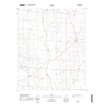
2020 Map of Banks
USGS Topo · Published 2020About this map
Moro Cr serves as a winding natural boundary between Calhoun and Bradley counties, defining the center of this rural landscape. The settlement of Banks sits at the intersection of local roads in the northeast, while Tinsman and Summerville anchor the western reaches. The area is characterized by a dense network of watercourses, including Hurricane Cr and Caney Cr, which drain the timberlands and small family farms that have historically supported these communities. Genealogists will find several burial sites noted, such as McFarland Cem near Banks and Childs Cem to the south. The terrain is marked by distinct features like Cagle Spring and the expansive Harrell Lake, illustrating the water-rich geography of southern Arkansas as it appeared in recent years.
Find a feature on this map
69 named features on this map. Tap any name to fly to it.
Don’t see what you’re looking for? This feature index may not catch every label — zoom into the map to look around manually.
Map Details
Editions of this 2020 Banks Map
This is the sole edition of this map. No revisions or reprints were ever made.
Other maps of this area

1934 · Ingalls
USGS Topo · 1:48,000

1934 · Moro Bay
USGS Topo · 1:62,500

1937 · Ingalls
USGS Topo · 1:62,500

1938 · Moro Bay
USGS Topo · 1:62,500

1939 · Moro Bay
USGS Topo · 1:62,500

1939 · Ingalls
USGS Topo · 1:62,500

1953 · El Dorado
USGS Topo · 1:250,000

1957 · El Dorado
USGS Topo · 1:250,000

1958 · El Dorado
USGS Topo · 1:250,000

1960 · El Dorado
USGS Topo · 1:250,000