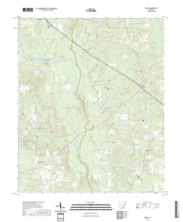
2024 Map of Banks
USGS Topo · Published 2024About this map
Moro Creek defines the center of this southern Arkansas landscape, serving as the boundary line between Calhoun and Bradley counties. The settlement of Banks serves as a local hub near the eastern edge, situated at the intersection of several regional routes including S Rock Island Rd and Armstrong Rd. The geography is characterized by a dense network of watercourses, with the Hurricane Branch and Caney Creek feeding into the central drainage basin.
Find a feature on this map
72 named features on this map. Tap any name to fly to it.
Don’t see what you’re looking for? This feature index may not catch every label — zoom into the map to look around manually.
Map Details
Editions of this 2024 Banks Map
This is the sole edition of this map. No revisions or reprints were ever made.
Other maps of this area

1934 · Ingalls
USGS Topo · 1:48,000

1934 · Moro Bay
USGS Topo · 1:62,500

1937 · Ingalls
USGS Topo · 1:62,500

1938 · Moro Bay
USGS Topo · 1:62,500

1939 · Moro Bay
USGS Topo · 1:62,500

1939 · Ingalls
USGS Topo · 1:62,500

1953 · El Dorado
USGS Topo · 1:250,000

1957 · El Dorado
USGS Topo · 1:250,000

1958 · El Dorado
USGS Topo · 1:250,000

1960 · El Dorado
USGS Topo · 1:250,000