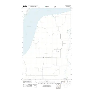
2011 Map of Banks
USGS Topo · Published 2011About this map
Lake Sakakawea and the Missouri River dominate the western and northern edges of this northern McKenzie County landscape, where the prairie meets the engineered waters of the mid-twentieth century. The settlement of Banks sits at a crossroads in the center of the sheet, surrounded by a high density of named ranching properties that speak to the long-standing agricultural lineage of the region. Local family history is etched into the terrain through landmarks like the C Wilson Ranch, M Wald Ranch, and the J Grantier Ranch. To the east, Tobacco Garden Creek meanders toward the reservoir, passing the Garden Valley Cemetery, a vital site for genealogical research in this sparsely populated stretch of the Badlands. Across the water to the northwest, the boundaries of Lewis and Clark State Park mark the transition from working ranch land to public recreation.
Find a feature on this map
12 named features on this map. Tap any name to fly to it.
Don’t see what you’re looking for? This feature index may not catch every label — zoom into the map to look around manually.
Map Details
Editions of this 2011 Banks Map
This is the sole edition of this map. No revisions or reprints were ever made.
Other maps of this area

1911 · Ray
USGS Topo · 1:125,000

1953 · Williston
USGS Topo · 1:250,000

1953 · Watford City
USGS Topo · 1:250,000

1957 · Williston
USGS Topo · 1:250,000

1957 · Watford City
USGS Topo · 1:250,000

1967 · Watford City
USGS Topo · 1:250,000

1969 · Cussicks Spring
USGS Topo · 1:24,000

1969 · Red Mike Hill
USGS Topo · 1:24,000

1978 · Tobacco Garden Bay
USGS Topo · 1:24,000

1978 · Watford City NE
USGS Topo · 1:24,000