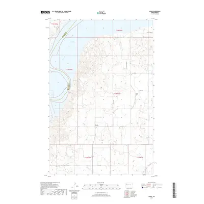
2017 Map of Banks
USGS Topo · Published 2017About this map
The settlement of Banks serves as a quiet focal point in this portion of McKenzie County, situated amidst the high plains terrain south of Lake Sakakawea. This landscape is defined by the deep dissection of the Missouri River valley, where the Missouri River itself flows through the northwest corner of the sheet, marking the boundary between Williams and McKenzie counties. The map illustrates a sparse, agricultural settlement pattern typical of the North Dakota badlands and prairie transition, with local travel centered on routes like Tobacco Garden Rd and W Tobacco Garden Rd. Genealogists may find interest in the isolated Garden Valley Cem located in the eastern sections, while the drainage patterns of Tobacco Garden Cr and Clear Cr show the rugged hydrology that shaped early ranching and farming in this region.
Find a feature on this map
22 named features on this map. Tap any name to fly to it.
Don’t see what you’re looking for? This feature index may not catch every label — zoom into the map to look around manually.
Map Details
Editions of this 2017 Banks Map
This is the sole edition of this map. No revisions or reprints were ever made.
Other maps of this area

1911 · Ray
USGS Topo · 1:125,000

1953 · Williston
USGS Topo · 1:250,000

1953 · Watford City
USGS Topo · 1:250,000

1957 · Williston
USGS Topo · 1:250,000

1957 · Watford City
USGS Topo · 1:250,000

1967 · Watford City
USGS Topo · 1:250,000

1969 · Cussicks Spring
USGS Topo · 1:24,000

1969 · Red Mike Hill
USGS Topo · 1:24,000

1978 · Tobacco Garden Bay
USGS Topo · 1:24,000

1978 · Watford City NE
USGS Topo · 1:24,000