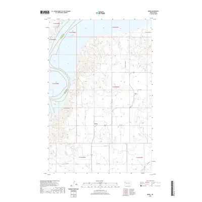
2020 Map of Banks
USGS Topo · Published 2020About this map
Lake Sakakawea dominates the northern reaches of this McKenzie County landscape, where the waters meet the winding drainages of Tobacco Garden Cr and Clear Cr. The small community of Banks serves as a central point in a region defined by its wide section-line roads and rolling breaks leading toward the Missouri River valley. To the east, the Garden Valley Cem provides a focal point for genealogical interest, situated near the intersection of 45th St NW and Tobacco Garden Cr. The map illustrates a contemporary rural structure where modern routes like Tobacco Garden Rd and W Tobacco Garden Rd follow the natural contours of the high plains, connecting isolated farmsteads across the township lines of the North Dakota badlands fringe.
Find a feature on this map
16 named features on this map. Tap any name to fly to it.
Don’t see what you’re looking for? This feature index may not catch every label — zoom into the map to look around manually.
Map Details
Editions of this 2020 Banks Map
This is the sole edition of this map. No revisions or reprints were ever made.
Other maps of this area

1911 · Ray
USGS Topo · 1:125,000

1953 · Williston
USGS Topo · 1:250,000

1953 · Watford City
USGS Topo · 1:250,000

1957 · Williston
USGS Topo · 1:250,000

1957 · Watford City
USGS Topo · 1:250,000

1967 · Watford City
USGS Topo · 1:250,000

1969 · Cussicks Spring
USGS Topo · 1:24,000

1969 · Red Mike Hill
USGS Topo · 1:24,000

1978 · Tobacco Garden Bay
USGS Topo · 1:24,000

1978 · Watford City NE
USGS Topo · 1:24,000