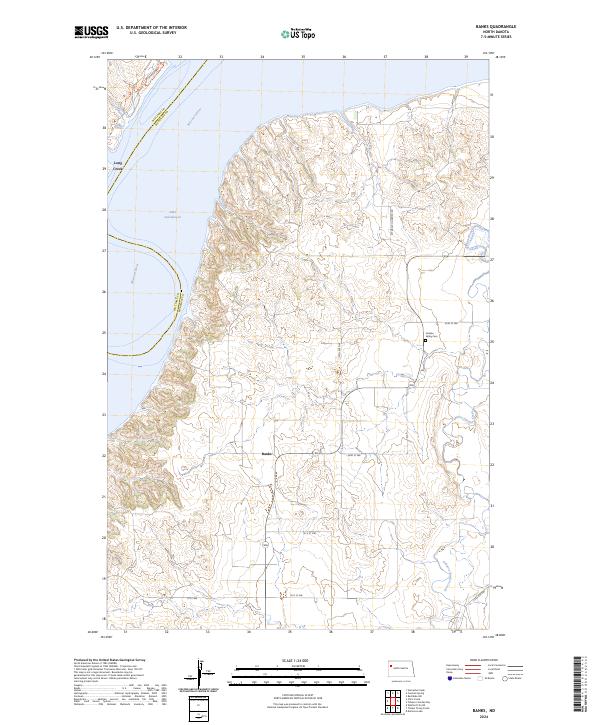
2024 Map of Banks
USGS Topo · Published 2024About this map
Lake Sakakawea and the winding Missouri River define the western reaches of this McKenzie County landscape. The settlement of Banks serves as a local navigational point at the junction of 43rd St NW and Highway 1806, situated on the high ground overlooking the river valley. To the east, the terrain is carved by the drainages of Tobacco Garden Creek and Long Creek, reflecting the intricate topography of the Missouri Plateau. Evidence of early community life is preserved at the Garden Valley Cem, located along 45th St NW. The map illustrates the contemporary section-line road network, such as W Tobacco Garden Rd and 118th Ave NW, which provides access to the agricultural tracts and coulees that characterize this part of North Dakota.
Find a feature on this map
22 named features on this map. Tap any name to fly to it.
Don’t see what you’re looking for? This feature index may not catch every label — zoom into the map to look around manually.
Map Details
Editions of this 2024 Banks Map
This is the sole edition of this map. No revisions or reprints were ever made.
Other maps of this area

1911 · Ray
USGS Topo · 1:125,000

1953 · Williston
USGS Topo · 1:250,000

1953 · Watford City
USGS Topo · 1:250,000

1957 · Williston
USGS Topo · 1:250,000

1957 · Watford City
USGS Topo · 1:250,000

1967 · Watford City
USGS Topo · 1:250,000

1969 · Cussicks Spring
USGS Topo · 1:24,000

1969 · Red Mike Hill
USGS Topo · 1:24,000

1978 · Tobacco Garden Bay
USGS Topo · 1:24,000

1978 · Watford City NE
USGS Topo · 1:24,000