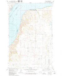
1978 Map of Banks
USGS Topo · Published 1979About this map
Lake Sakakawea and the Missouri River dominate the northwestern corner of this landscape, marking the border between Williams and McKenzie Counties. In the late 1970s, the terrain south of the water rises into the broad topographic feature of Twin Valley, where the small settlement of Banks sits at a junction of light-duty roads. This area is characterized by significant public lands and conservation efforts, including the Tobacco Garden Creek State Game Management Area and the northern reaches of the Little Missouri National Grassland.
Find a feature on this map
20 named features on this map. Tap any name to fly to it.
Don’t see what you’re looking for? This feature index may not catch every label — zoom into the map to look around manually.
Map Details
Editions of this 1978 Banks Map
This is the sole edition of this map. No revisions or reprints were ever made.
Other maps of this area

1911 · Ray
USGS Topo · 1:125,000

1953 · Williston
USGS Topo · 1:250,000

1953 · Watford City
USGS Topo · 1:250,000

1957 · Williston
USGS Topo · 1:250,000

1957 · Watford City
USGS Topo · 1:250,000

1967 · Watford City
USGS Topo · 1:250,000

1969 · Cussicks Spring
USGS Topo · 1:24,000

1969 · Red Mike Hill
USGS Topo · 1:24,000

1978 · Tobacco Garden Bay
USGS Topo · 1:24,000

1978 · Watford City NE
USGS Topo · 1:24,000