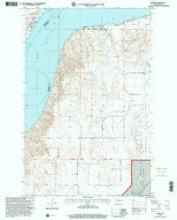
1997 Map of Banks
USGS Topo · Published 2001About this map
Lake Sakakawea and the winding course of the Missouri River define the northwestern corner of this McKenzie County landscape, where the water meets the breaks of Twin Valley. The 1990s terrain is characterized by the high-plateau prairies and coulees of the Little Missouri National Grassland, punctuated by family landmarks like the J Grantier Ranch and the small settlement of Banks. This survey documents a rural infrastructure dependent on natural resources, evidenced by a Scoria Pit and Gravel Pit near the Thirteenth Standard Parallel North. For those tracing local heritage, the Garden Valley Cem remains a primary anchor of the community's history. The map also captures the extensive boundaries of the Lewis and Clark State Park and the Tobacco Garden Creek State Game Management Area, highlighting the region's commitment to conservation and public land management along the Tobacco Garden Creek.
Find a feature on this map
19 named features on this map. Tap any name to fly to it.
Don’t see what you’re looking for? This feature index may not catch every label — zoom into the map to look around manually.
Map Details
Editions of this 1997 Banks Map
This is the sole edition of this map. No revisions or reprints were ever made.
Other maps of this area

1911 · Ray
USGS Topo · 1:125,000

1953 · Williston
USGS Topo · 1:250,000

1953 · Watford City
USGS Topo · 1:250,000

1957 · Williston
USGS Topo · 1:250,000

1957 · Watford City
USGS Topo · 1:250,000

1967 · Watford City
USGS Topo · 1:250,000

1969 · Cussicks Spring
USGS Topo · 1:24,000

1969 · Red Mike Hill
USGS Topo · 1:24,000

1978 · Tobacco Garden Bay
USGS Topo · 1:24,000

1978 · Watford City NE
USGS Topo · 1:24,000