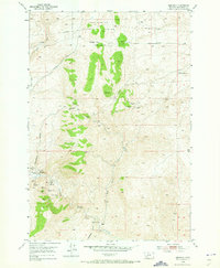
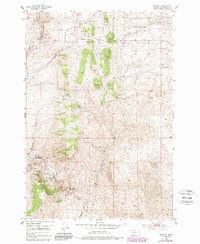
1952 Map of Bannack
USGS Topo · Published 1973About this map
Bannack stands as the focal point of this mid-century survey, documented here shortly after its designation as a Montana landmark. The map detail highlights the intense mining history that defined the area, showing a landscape carved by claims such as the Golden Leaf Mine, Hendricks Lode Mine, and the Hope Placer Mine. While most workings were inactive by the time of the 1952 field check, the New Departure Mine and Blue Dot Mine remain noted as active operations. The terrain is marked by evocative local nomenclature, from the steep ascent of Badger Pass to the foreboding Hangmans Gulch and Road Agents Rock, reflecting the area's transition from a bustling gold rush center to a preserved historical site. Water from Grasshopp Creek and Taylor Creek continues to dictate the local geography, winding through the Beaverhead National Forest boundary.
Find a feature on this map
31 named features on this map. Tap any name to fly to it.
Don’t see what you’re looking for? This feature index may not catch every label — zoom into the map to look around manually.
Map Details
Editions of this 1952 Bannack Map
6 editions found
Other maps of this area

1893 · Dillon
USGS Topo · 1:250,000

1952 · Argenta
USGS Topo · 1:24,000

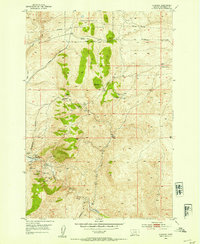
1952 · Bannack
USGS Topo · 1:24,000

1952 · Burns Mountain
USGS Topo · 1:24,000

1952 · Eli Spring
USGS Topo · 1:24,000

1952 · Dalys
USGS Topo · 1:24,000

1952 · Ermont
USGS Topo · 1:24,000

1955 · Dillon
USGS Topo · 1:250,000

1957 · Dillon
USGS Topo · 1:250,000

1958 · Dillon
USGS Topo · 1:250,000