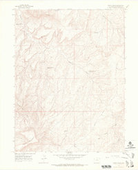
1964 Map of Banta Ridge
USGS Topo · Published 1968About this map
Rabbit Mountain and the Gilsonite Hills define this high-desert landscape in Rio Blanco County, mapped during a period of expanding energy exploration in the mid-1960s. The terrain is characterized by a series of high-altitude water catchments, including Banta Flats Reservoir, Shavetail Reservoir, and several basins along Cottonwood Creek. These water features, alongside a network of jeep trails and a significant pipeline, reflect the region's adaptation for industrial use and resource management. Grounded in 1963 aerial photography, the sheet identifies specific gas wells and scattered drill holes that trace the footprint of the petroleum industry's reach into the remote plateaus. From the prominent Banta Ridge in the north to the depths of Big Horse Draw, the map provides an exact record of the area's geological and industrial state before further modern development.
Find a feature on this map
20 named features on this map. Tap any name to fly to it.
Don’t see what you’re looking for? This feature index may not catch every label — zoom into the map to look around manually.
Map Details
Editions of this 1964 Banta Ridge Map
3 editions found
Other maps of this area

1885 · East Tavaputs
USGS Topo · 1:250,000

1885 · Ashley
USGS Topo · 1:250,000

1907 · Rangely
USGS Topo · 1:125,000

1907 · Jensen
USGS Topo · 1:125,000

1910 · Jensen
USGS Topo · 1:125,000

1910 · Rangely
USGS Topo · 1:125,000

1954 · Vernal
USGS Topo · 1:250,000

1956 · Grand Junction
USGS Topo · 1:250,000

1958 · Vernal
USGS Topo · 1:250,000

1959 · Grand Junction
USGS Topo · 1:250,000