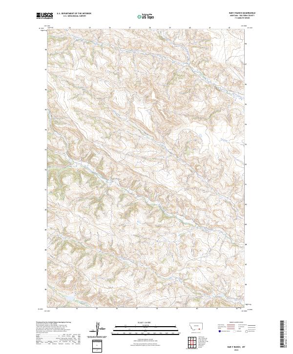
2024 Map of Bar V Ranch
USGS Topo · Published 2024About this map
Youngs Creek and Squirrel Creek carve through this section of Big Horn County, defining a landscape marked by complex drainage networks and significant elevation changes. This modern survey illustrates the persistent importance of water management and access in the region, evidenced by the Canal Rd and Youngs Creek Rd corridors. The terrain is characterized by numerous seasonal and perennial watercourses, including the North Fork Squirrel Creek and the southern reaches of Tanner Creek. A localized water source, the 08S38E31CADC01 Spring, serves as a specific point of interest in the northwestern corner. The map traces the natural flow of Little Youngs Creek and Ash Creek across the township and range boundaries, reflecting the remote ranching character of this Montana borderland.
Find a feature on this map
15 named features on this map. Tap any name to fly to it.
Don’t see what you’re looking for? This feature index may not catch every label — zoom into the map to look around manually.
Map Details
Editions of this 2024 Bar V Ranch Map
This is the sole edition of this map. No revisions or reprints were ever made.
Other maps of this area

1894 · Rosebud
USGS Topo · 1:125,000

1895 · Dayton
USGS Topo · 1:125,000

1901 · Rosebud
USGS Topo · 1:125,000

1901 · Dayton
USGS Topo · 1:125,000

1909 · Sheridan
USGS Topo · 1:125,000

1911 · Sheridan
USGS Topo · 1:125,000

1954 · Hardin
USGS Topo · 1:250,000

1955 · Sheridan
USGS Topo · 1:250,000

1957 · Hardin
USGS Topo · 1:250,000

1958 · Hardin
USGS Topo · 1:250,000