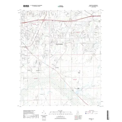
2018 Map of Barachias
USGS Topo · Published 2018About this map
Barachias and Pike Road anchor the southeastern portion of this map, illustrating the transition from the expanding city of Montgomery into a rural landscape of named family burial grounds and agrarian landmarks. The presence of Perrys Mill on Jenkins Creek and the associated Perrys Mill Cemetery points to the early local industry that once defined these crossroads. Education and aviation are prominent features of the northern sector, with large campuses for Auburn Univ - Montgomery and Amridge Univ near Kershaw Airport. The terrain is shaped by the winding paths of Catoma Creek and Little Catoma Creek, which create natural boundaries between established neighborhoods and the open fields of Macedonia and Pinedale. Small-scale water features like Miller Pond and Herman Gibson Lake further characterize the hydrology of this Alabama Piedmont area.
Find a feature on this map
244 named features on this map. Tap any name to fly to it.
Don’t see what you’re looking for? This feature index may not catch every label — zoom into the map to look around manually.
Map Details
Editions of this 2018 Barachias Map
This is the sole edition of this map. No revisions or reprints were ever made.
Other maps of this area

1927 · Montgomery
USGS Topo · 1:48,000

1930 · Montgomery
USGS Topo · 1:62,500

1953 · Montgomery
USGS Topo · 1:250,000

1956 · Montgomery
USGS Topo · 1:250,000

1957 · Montgomery
USGS Topo · 1:250,000

1957 · Letohatchee
USGS Topo · 1:62,500

1958 · Montgomery
USGS Topo · 1:62,500

1958 · Montgomery North
USGS Topo · 1:24,000

1958 · Montgomery South
USGS Topo · 1:24,000

1958 · Mount Meigs
USGS Topo · 1:62,500