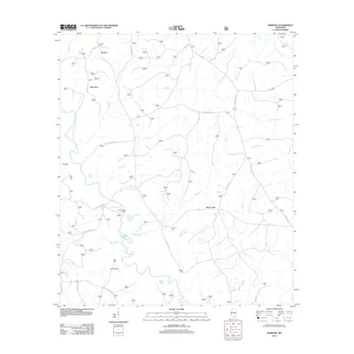
2012 Map of Barbara
USGS Topo · Published 2012About this map
Black Creek and its many meandering tributaries, including Deep Creek and Beaver Creek, define the water-rich landscape of this Perry County locale. The settlement at Batt Place and the crossroads of Barbara anchor the northern reaches, while the Fairley Bridge Landing provides a specific point of historical river access along the southern bends of the creek. Genealogy researchers will find numerous family-associated sites, such as Thomas Cem, Cochran Cem, and O'Neal Cem, scattered throughout the rural landscape. The terrain transitions from the lowlands around Horseshoe Lake and Lang Lake to higher ground at Red Hills and Steve Hills. A network of forest service roads and local routes like Mars Hill Rd and Fairley Bridge Rd connect these isolated homesteads and burial grounds, reflecting a persistent pattern of rural habitation.
Find a feature on this map
44 named features on this map. Tap any name to fly to it.
Don’t see what you’re looking for? This feature index may not catch every label — zoom into the map to look around manually.
Map Details
Editions of this 2012 Barbara Map
This is the sole edition of this map. No revisions or reprints were ever made.
Other maps of this area

1947 · Beaumont
USGS Topo · 1:62,500

1947 · Wiggins
USGS Topo · 1:62,500

1947 · New Augusta
USGS Topo · 1:62,500

1947 · Benndale
USGS Topo · 1:62,500

1949 · Wiggins
USGS Topo · 1:62,500

1949 · Beaumont
USGS Topo · 1:62,500

1949 · New Augusta
USGS Topo · 1:62,500

1949 · Benndale
USGS Topo · 1:62,500

1953 · Hattiesburg
USGS Topo · 1:250,000

1953 · Mobile
USGS Topo · 1:250,000