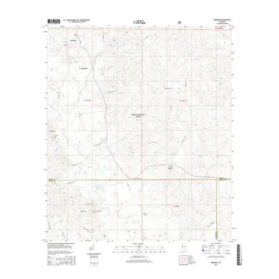
2015 Map of Barbara
USGS Topo · Published 2015About this map
The Desoto National Forest dominates the center of this Mississippi landscape, where the headwaters of numerous creeks begin their descent toward the Gulf. Smaller settlements like Barbara and Batt Place are established along the north, while the southern terrain transitions into the Steve Hills. A dense network of family-named cemeteries, including Thomas Cem, Cochran Cem, and O'Neal Cem, suggests a long history of rural homesteads and tight-knit communities across the Perry, Stone, and George county lines. The water-rich environment is defined by distinctive features such as Horseshoe Lake and the meandering Black Creek, while named rural routes like Fairley Bridge Rd and Miles Cemetery Rd provide a clear view of the local infrastructure in the mid-2010s.
Find a feature on this map
51 named features on this map. Tap any name to fly to it.
Don’t see what you’re looking for? This feature index may not catch every label — zoom into the map to look around manually.
Map Details
Editions of this 2015 Barbara Map
This is the sole edition of this map. No revisions or reprints were ever made.
Other maps of this area

1947 · Beaumont
USGS Topo · 1:62,500

1947 · Wiggins
USGS Topo · 1:62,500

1947 · New Augusta
USGS Topo · 1:62,500

1947 · Benndale
USGS Topo · 1:62,500

1949 · Wiggins
USGS Topo · 1:62,500

1949 · Beaumont
USGS Topo · 1:62,500

1949 · New Augusta
USGS Topo · 1:62,500

1949 · Benndale
USGS Topo · 1:62,500

1953 · Hattiesburg
USGS Topo · 1:250,000

1953 · Mobile
USGS Topo · 1:250,000