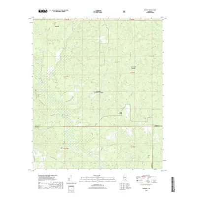
2018 Map of Barbara
USGS Topo · Published 2018About this map
De Soto National Forest covers much of this landscape in southern Mississippi, where the piney woods are marked by a dense network of cemeteries and forest trails. The terrain is defined by the winding course of Black Creek, which flows through the center of the sheet, joined by tributaries such as Indian Br and Beaver Cr. In the northern section, the small settlement of Barbara sits along Snider Rd, while the eastern edge includes a portion of MTA Camp Shelby. Genealogists will find a high concentration of burial sites, including the Thomas Cem, Red Hill Cem, and O'Neal Cem, scattered across the rural townships. The presence of Long Lake and Horseshoe Lake near the confluence of Black Creek and Mill Cr highlights the low-lying, fluvial nature of the local environment within the forest boundaries.
Find a feature on this map
53 named features on this map. Tap any name to fly to it.
Don’t see what you’re looking for? This feature index may not catch every label — zoom into the map to look around manually.
Map Details
Editions of this 2018 Barbara Map
This is the sole edition of this map. No revisions or reprints were ever made.
Other maps of this area

1947 · Beaumont
USGS Topo · 1:62,500

1947 · Wiggins
USGS Topo · 1:62,500

1947 · New Augusta
USGS Topo · 1:62,500

1947 · Benndale
USGS Topo · 1:62,500

1949 · Wiggins
USGS Topo · 1:62,500

1949 · Beaumont
USGS Topo · 1:62,500

1949 · New Augusta
USGS Topo · 1:62,500

1949 · Benndale
USGS Topo · 1:62,500

1953 · Hattiesburg
USGS Topo · 1:250,000

1953 · Mobile
USGS Topo · 1:250,000