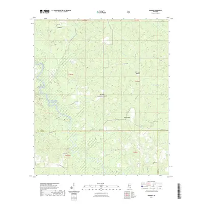
2021 Map of Barbara
USGS Topo · Published 2021About this map
The De Soto National Forest dominates this landscape in southern Mississippi, where the Black Creek Wild and Scenic River carves a path through the pines. Small settlements like Barbara and Steve Hills are connected by a network of rural routes, including Snider Rd and N E Breland Rd. For those researching local families, the map is a vital resource, identifying several secluded burial grounds such as Thomas Cem, Cochran Cem, and Miles Cem.
Find a feature on this map
58 named features on this map. Tap any name to fly to it.
Don’t see what you’re looking for? This feature index may not catch every label — zoom into the map to look around manually.
Map Details
Editions of this 2021 Barbara Map
This is the sole edition of this map. No revisions or reprints were ever made.
Other maps of this area

1947 · Beaumont
USGS Topo · 1:62,500

1947 · Wiggins
USGS Topo · 1:62,500

1947 · New Augusta
USGS Topo · 1:62,500

1947 · Benndale
USGS Topo · 1:62,500

1949 · Wiggins
USGS Topo · 1:62,500

1949 · Beaumont
USGS Topo · 1:62,500

1949 · New Augusta
USGS Topo · 1:62,500

1949 · Benndale
USGS Topo · 1:62,500

1953 · Hattiesburg
USGS Topo · 1:250,000

1953 · Mobile
USGS Topo · 1:250,000