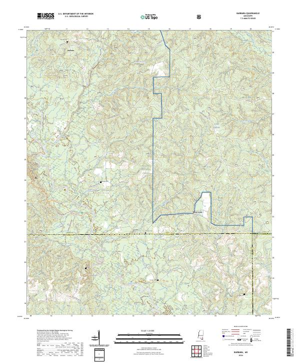
2024 Map of Barbara
USGS Topo · Published 2024About this map
De Soto National Forest dominates this landscape, where the protected corridor of the Black Creek Wild and Scenic River meanders through the pine-covered lowlands. The map reveals a high density of small family burial grounds, providing an invaluable record for genealogists tracing South Mississippi heritage. From the northern settlement of Barbara to the southern reaches near Whites Crossing, these sites—including Thomas Cem, Fairley Cem, and Miles Cem—are scattered along rural routes like Snider Rd and Fairley Cemetery Rd. The terrain is defined by the Red Hills and Steve Hills, with an intricate drainage network of creeks such as Beaver Creek and Mill Creek feeding into the larger Black Creek basin. Portions of the Camp Shelby military installation intersect with the forest lands, highlighting the area's dual role in federal land management and conservation.
Find a feature on this map
55 named features on this map. Tap any name to fly to it.
Don’t see what you’re looking for? This feature index may not catch every label — zoom into the map to look around manually.
Map Details
Editions of this 2024 Barbara Map
This is the sole edition of this map. No revisions or reprints were ever made.
Other maps of this area

1947 · Beaumont
USGS Topo · 1:62,500

1947 · Wiggins
USGS Topo · 1:62,500

1947 · New Augusta
USGS Topo · 1:62,500

1947 · Benndale
USGS Topo · 1:62,500

1949 · Wiggins
USGS Topo · 1:62,500

1949 · Beaumont
USGS Topo · 1:62,500

1949 · New Augusta
USGS Topo · 1:62,500

1949 · Benndale
USGS Topo · 1:62,500

1953 · Hattiesburg
USGS Topo · 1:250,000

1953 · Mobile
USGS Topo · 1:250,000